Connect ArcGIS and cloudi-fi to Build Intelligent Automations
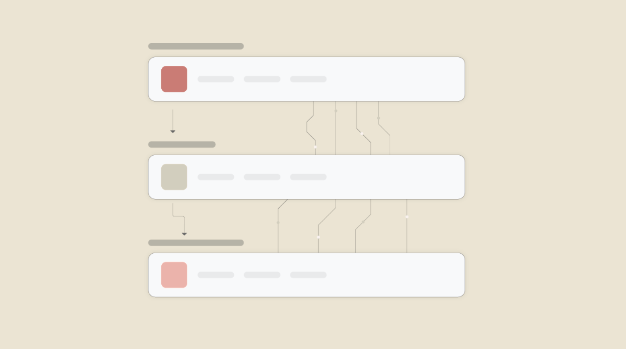
Choose a Trigger

When this happens...
- Request a new Trigger for ArcGIS
Choose an Action

Automatically do this!
- Request a new Action for cloudi-fi
Enable Integrations or automations with these events of ArcGIS and cloudi-fi
Enable Integrations or automations with these events of ArcGIS and cloudi-fi
Actions
Get Items
Get the details of all existing items.
Explore more automations built by businesses and experts
Automate AI Task Runs: Webhook to MCP API (POST JSON)
Automate Instagram Comment Replies with Smart Keywords + Auto DMs
Automate Social Media Post Creation and Scheduling Across Multiple Platforms


Know More About Arcgis and Cloudi Fi Integrations
How viaSocket Works | A Complete Guide
Gain insights into how viaSocket functions through our detailed guide. Understand its key features and benefits to maximize your experience and efficiency.

5 Simple Automation Hacks to Make Your Team Free
Unlock your team's potential with 5 straightforward automation hacks designed to streamline processes and free up valuable time for more important work.
What is Workflow Automation - Definition, Importance & Benefits | A Complete Guide
Workflow automation is the process of using technology to execute repetitive tasks with minimal human intervention, creating a seamless flow of activities.
Frequently Asked Questions
To start, connect both your ArcGIS and cloudi-fi accounts to viaSocket. Once connected, you can set up a workflow where an event in ArcGIS triggers actions in cloudi-fi (or vice versa).
Absolutely. You can customize how ArcGIS data is recorded in cloudi-fi. This includes choosing which data fields go into which fields of cloudi-fi, setting up custom formats, and filtering out unwanted information.
The data sync between ArcGIS and cloudi-fi typically happens in real-time through instant triggers. And a maximum of 15 minutes in case of a scheduled trigger.
Yes, viaSocket allows you to add custom logic or use built-in filters to modify data according to your needs.
Yes, you can set conditional logic to control the flow of data between ArcGIS and cloudi-fi. For instance, you can specify that data should only be sent if certain conditions are met, or you can create if/else statements to manage different outcomes.
About ArcGIS
ArcGIS is a comprehensive geographic information system (GIS) for working with maps and geographic information. It is used for creating, managing, sharing, and analyzing spatial data.
Learn MoreAbout cloudi-fi
Cloudi-Fi enhance your Guest experience while accessing your Wifi networks.
Learn MoreviaSocket
For SaaS
For AI Agent Builders
Support
Automation Experts

Plans, Pricing and Offer
AI & Automation
© 2026 viaSocket |Privacy,TermsandData Retention & Deletion Policy
Walkover Web Solutions Pvt Ltd. | All rights reserved.